Reserve direct
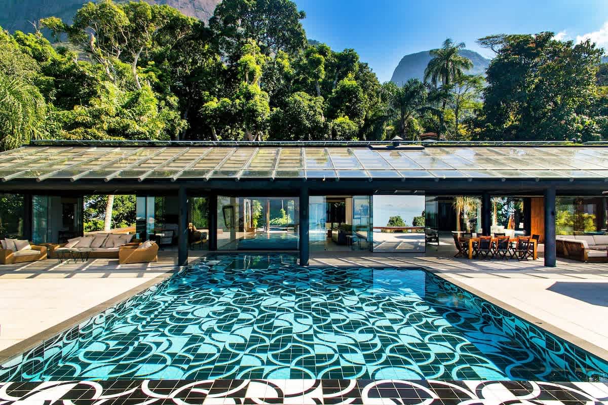
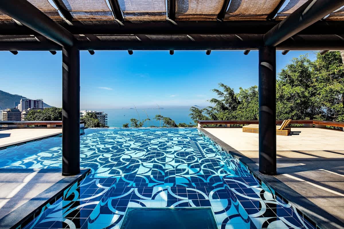
We run a five-suite villa with an infinity pool above São Conrado beach, and its rates and live availability are on the Art de Vivre booking page.
Book directGetting to the ferry
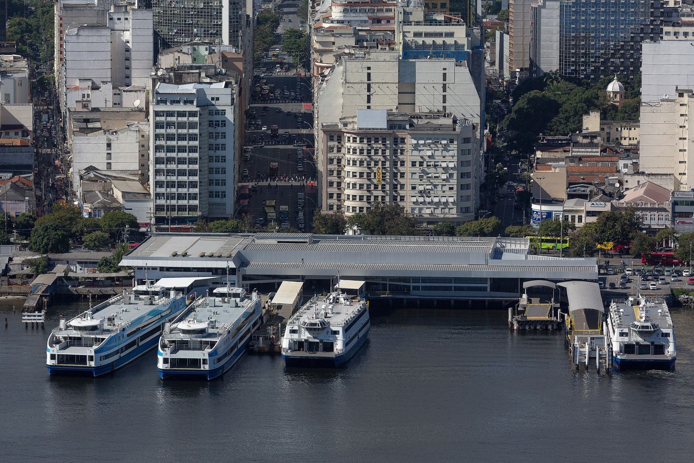
The ferries to Niterói leave from Praça XV, in Rio's old centre, about 23 km from São Conrado by road. An English-speaking driver, arranged through Art de Vivre's concierge, can drop you at the terminal; allow 30 to 45 minutes, more at rush hour.
The boats leave from the ferry station at Praça XV, so check which dock serves your line. The crossing to Praça Araribóia in central Niterói takes about 20 minutes. Since 12 February 2025 the boats have been run by Barcas Rio, a consortium that won the state tender in November 2024 and took over from CCR Barcas; in its first year it carried 13.5 million passengers, and around 45,000 people ride each day, so the commuter hours are the busiest.
A second line runs between Praça XV and Charitas, and the Charitas terminal, opened in 2004, is one of Oscar Niemeyer's buildings. Fares are modest; check the current price and timetable before you travel. While you are at Praça XV, Rio's historic centre is on the doorstep.
Niterói
Niterói faces Rio across Guanabara Bay and is a city in its own right, with about 480,000 people at the 2022 census. It was founded on 22 November 1573 by Araribóia, a Tupi chief, and the ferry square, Praça Araribóia, carries his name.
Many visitors cross for the view back at Rio. From the seafront at Icaraí, Niterói's most traditional neighbourhood, Rio's landmarks line up across the water, and the promenade is a favourite for running and cycling. The south zone around Icaraí began to be urbanised in 1841.
Close to the MAC, the small Ilha da Boa Viagem is joined to the shore by a bridge built in the 1970s. The chapel of Nossa Senhora da Boa Viagem, from the 18th century, stands at its highest point, and the island's old battery was heavily shelled during the Revolta da Armada in 1893. The island has free guided visits, with the days and times on the city's tourism site, so check them before you go; wet weather can cancel visits.
MAC and the Caminho Niemeyer
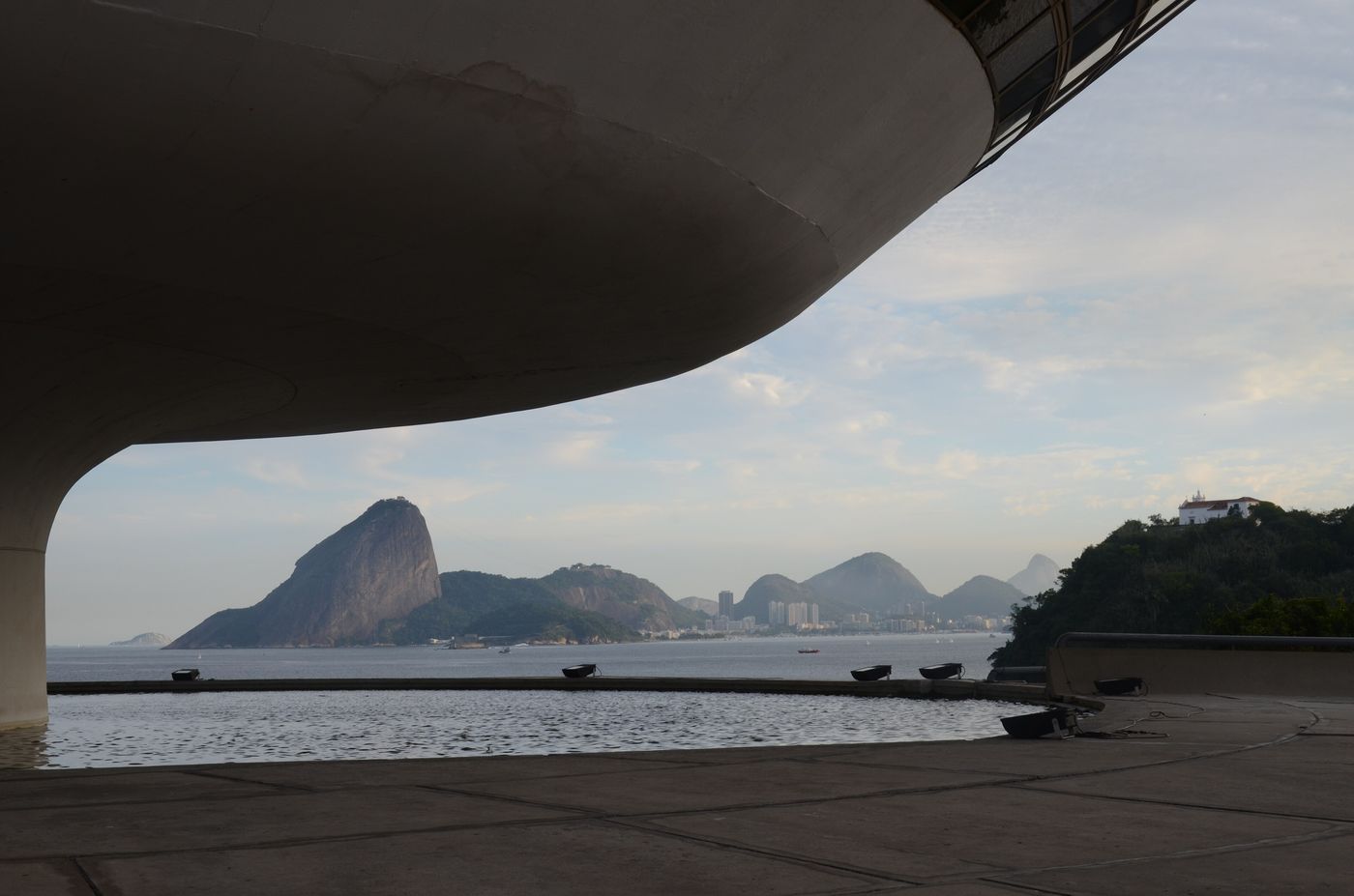
The Museu de Arte Contemporânea de Niterói, the MAC, opened on 2 September 1996. Oscar Niemeyer designed it with the structural engineer Bruno Contarini, who had worked with him before: a building 16 metres high with a cupola 50 metres across, set on a cylindrical base in an 817 m² reflecting pool. Niemeyer compared the shape to a flower.
The core of the museum's collection is that of João Sattamini, who began buying in 1966: 1,217 works lent to the museum, often described as the second-largest collection of contemporary art in Brazil. From the viewing gallery you look out over Guanabara Bay, Rio and the Sugarloaf, which for many visitors is the main event.
The MAC turned out to be the first piece of a larger plan. Niemeyer was invited to design the Caminho Niemeyer, a string of buildings along 11 km of waterfront between the centre and Charitas, and work began in January 2002. Nine projects are finished, among them the Memorial Roberto Silveira, the Teatro Popular and the headquarters of the Fundação Oscar Niemeyer on the Praça Popular, while a new cathedral there has been under construction since 2016. Others include the Parque das Águas (2006) and the Centro Petrobras de Cinema (2012).
The MAC is open Tuesday to Sunday from 10am to 6pm, with the last entry at 5.30pm. In 2026 tickets are around R$ 20, free on Wednesdays, and are paid in cash at the box office. Hours and prices change, so check them before you go.
Fortaleza de Santa Cruz da Barra
At the mouth of Guanabara Bay, in the Jurujuba neighbourhood, the Fortaleza de Santa Cruz da Barra was the main defence of the bay's entrance. The Portuguese held the site from 1584, and the fort took its present name in 1612; together with the Fortaleza de São João and the Forte Tamandaré da Laje, it could hold the entrance under crossfire.
The fort belongs to the Ministry of Defence and is run by the Brazilian Army, which still uses it: since 2005 it has housed the headquarters of the 1st Army Division's artillery. Visits are by guided tour, usually Tuesday to Sunday between about 10am and 4pm, and the Army asks groups to book ahead.
On weekdays you need a car or taxi to get there, so it fits best on a day when the driver is with you. Check the visiting days and times before you set out.
Parque da Cidade
For the view back to Rio, go up to the Parque da Cidade, about 15 hectares on top of the Morro da Viração at around 270 metres. Its two lookouts take in the lagoons and ocean beaches of Niterói, Guanabara Bay, the bridge and parts of Rio, including some of its best-known sights.
Hang-gliders and paragliders launch from the park's two ramps, much as they do from Pedra Bonita near the villa; there is more on that in hang-gliding in São Conrado. You reach the park by car or taxi. The late afternoon is the time to go, and the park's closing time is worth checking if you plan to stay for the sunset. Itaipu, on the ocean side, is another place to watch the sun go down over Rio's shoreline, and if you would rather see it from the Rio side, read about sunset at Arpoador.
Itacoatiara and the Costão
Itacoatiara, on Niterói's ocean side, is a surfers' beach, and the sea can be strong, so swim only when it is calm and follow the lifeguards' flags.
Above the beach rises the Costão, about 217 metres high, inside the Serra da Tiririca State Park, created on 29 November 1991 to protect Atlantic Forest, springs and wildlife. The climb takes roughly 30 to 40 minutes and gives the classic view down over Itacoatiara; start early, wear proper shoes and take water.
The park covers 3,493 hectares, including a marine area reaching about 1,700 metres offshore. It also takes in the Alto Mourão, at 369 metres, and the Morro do Elefante, at 412 metres, and it allows rappelling and rock climbing; the 2.2 km Darwin Trail crosses it between Engenho do Mato in Niterói and Itaocaia in Maricá. Its visitor centre is in Itacoatiara, and the park is generally open from 8am to 5pm; check the current days and hours before you set out.
By car over the bridge
The alternative to the ferry is the Rio-Niterói Bridge, officially the President Costa e Silva Bridge. Work began in 1969 and it opened on 4 March 1974, when it was the second-longest bridge in the world after the Lake Pontchartrain Causeway in the United States. It runs for 13.29 km, 8.84 km of them over water, and its 300-metre central span rises 72 metres above the bay so that the hundreds of ships that use the bay each month can pass underneath.
From São Conrado to the MAC by car is about 37 km across the bridge, around 45 minutes without traffic and much longer at rush hour, and there is a toll. The best of both is to take the ferry over and have the driver cross the bridge to meet you, so you come home by car at the end of the day.
A day in Niterói
Take a mid-morning ferry, after the commuter rush, with a light layer for the breeze on deck, and start with the MAC and a walk along the bay. Have lunch in Niterói, then let the driver take you to the Fortaleza de Santa Cruz for a guided tour.
Spend the late afternoon at Itacoatiara or go up to the Parque da Cidade for the view, then drive home over the bridge. If you only have half a day, the ferry and the MAC on their own make a fine outing.
Keep Niterói for a clear day, as the views back to Rio are the point of the trip. It also pairs well with a morning in the old centre around Praça XV before you board. For more ideas in the city, see things to do in Rio.
Questions
How long is the ferry from Rio to Niterói?
The crossing from Praça XV to Praça Araribóia takes about 20 minutes. The ferries have been run by the Barcas Rio consortium since February 2025.
Who designed the MAC in Niterói?
Oscar Niemeyer, with the structural engineer Bruno Contarini. The museum opened on 2 September 1996.
How long is the Rio-Niterói Bridge?
The bridge is 13.29 km long, with 8.84 km over water. It opened on 4 March 1974.
Can you visit the Fortaleza de Santa Cruz in Niterói?
Yes, on guided tours, usually Tuesday to Sunday during the day. The fort is run by the Brazilian Army, which asks groups to book ahead, so check the visiting days and times before you go.
Where is the best view of Rio from Niterói?
The Parque da Cidade, at about 270 metres on the Morro da Viração, looks over Guanabara Bay, the bridge and parts of Rio. The MAC's viewing gallery faces the bay and the Sugarloaf.
Cross the bay for a day and come home over the bridge to the villa above São Conrado: book direct with Art de Vivre, and the concierge will have the driver waiting on the Niterói side.
Sources
Facts on this page were checked against these sources in October 2026. Opening hours and prices change: confirm before you go.
- Barcas Rio (Wikipédia)
- Niterói (Wikipedia)
- Niterói (Wikivoyage)
- Niterói Contemporary Art Museum (Wikipedia)
- Museu de Arte Contemporânea de Niterói (Wikipédia)
- Caminho Niemeyer (Wikipédia)
- Fortaleza de Santa Cruz da Barra (Wikipédia)
- Parque da Cidade de Niterói (Wikipédia)
- Praia de Itacoatiara (Wikipédia)
- Serra da Tiririca State Park (Wikipedia)
- Rio-Niterói Bridge (Wikipedia)
- Ponte Rio-Niterói (Wikipédia)
- Ilha da Boa Viagem (Wikipédia)
- Ilha da Boa Viagem (Visit Niterói, prefeitura)
- Noite de festa celebra os 30 anos do MAC (Prefeitura de Niterói, 06/09/2026)
- Fortaleza de Santa Cruz da Barra (Visit Niterói, prefeitura)
- Serra da Tiririca State Park (Visit Niterói, prefeitura)
- Estação Praça XV, operator Barcas Rio (OpenStreetMap)
- OSRM route São Conrado to Praça XV (OpenStreetMap data)
- OSRM route São Conrado to MAC Niterói (OpenStreetMap data)